Draw each section as a grid.
Name a section, say how many rows and how many plots in a row, and SextonMap lays out a grid you can tap and zoom. Mark paths, trees and unusable ground, and join plots into doubles so the map matches the rows you walk.
Cemetery records for small cemeteries
For the volunteer sexton, church treasurer or township clerk. Draw each section as a grid, tap plots to record burials and deed holders, and with Pro publish a burial search page for families.

SOLO $19.99 A YEAR OR $49.99 ONCE · PRO $9.99 A MONTH OR $99.99 A YEAR
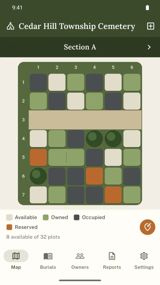
Name a section, say how many rows and how many plots in a row, and SextonMap lays out a grid you can tap and zoom. Mark paths, trees and unusable ground, and join plots into doubles so the map matches the rows you walk.
Colors show whether each plot is available, owned, occupied or reserved, and a plot with a burial always shows as occupied. The count of available plots sits under every section.
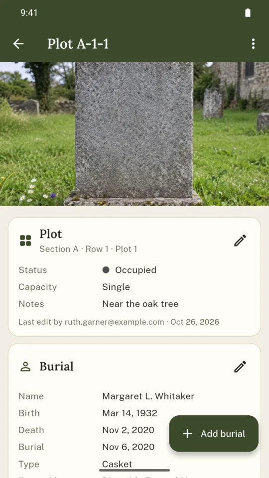
Name, birth, death and burial dates, casket or cremains, funeral home, officiant, inscription, notes and a headstone photo taken on the spot. A date can be a full date, a month and year, or only a year.
Each plot keeps its owner, contact, deed number, purchase date and price paid. The Owners tab lists deed holders and their plots, and Solo adds plot ownership record PDFs.
On Solo, import a CSV from Excel, Google Sheets or Numbers. SextonMap guesses which column holds names, dates, section, row and plot, lets you correct it, previews the result and skips rows already recorded.
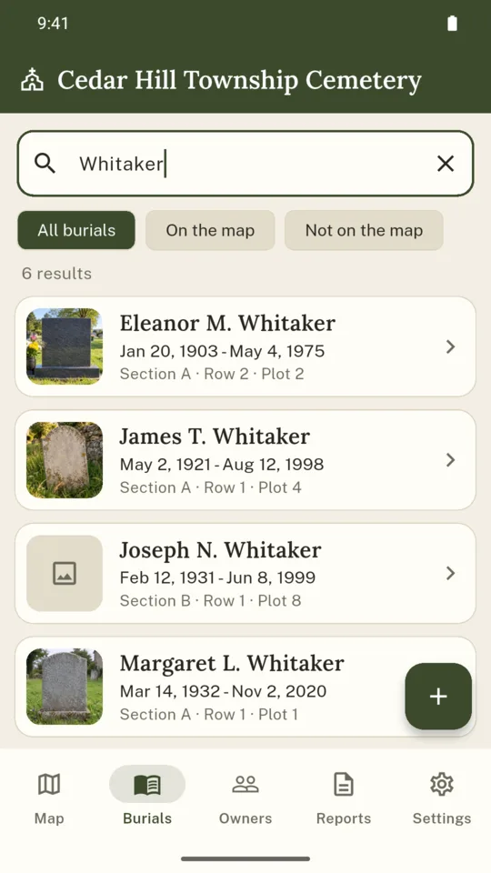
Families and genealogists search a surname on a page with your cemetery’s name and see dates, section, row and plot with a small map. Owners, deeds, prices and notes never appear there, and photos only where you switch them on.
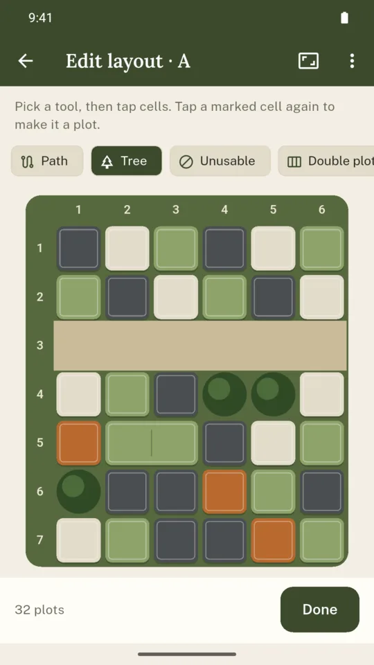
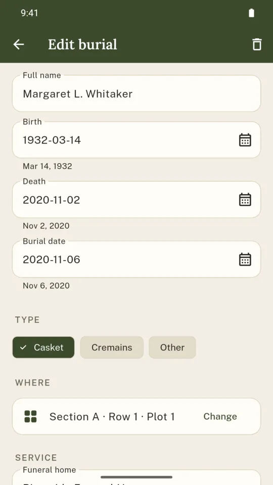
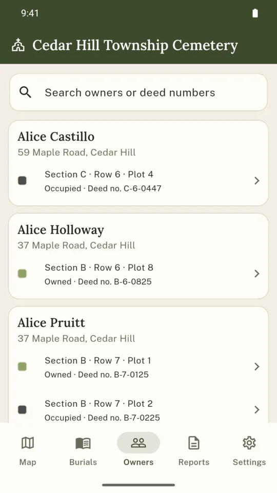
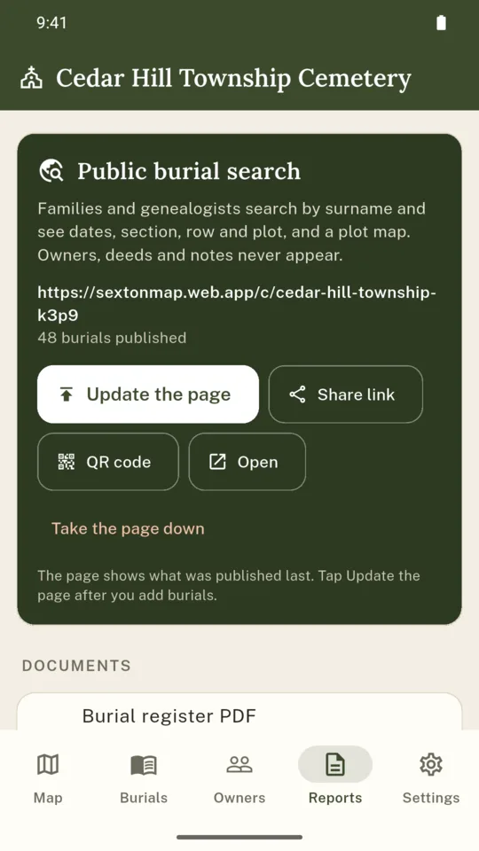
SextonMap’s grid shows your recorded layout, not surveyed boundaries. Draw the rows and plots of each section, then adjust the layout as you check it on site.
The map and records stay on the phone and keep working with no signal in the grounds. Changes sync to SextonMap’s servers when a connection returns, and volunteers get them when their phones sync.
Publishing copies names, dates and plot locations to the search page. Owner names, contacts, deeds and prices stay private, and the page changes only when you publish again.
Every record stays readable on every tier and exports as JSON at any time. If a paid plan ends, every record stays readable, and Standard keeps working with one section of up to 200 plots.
One section of up to 200 plots with burials, headstone photos, owners, search, the register and availability PDFs and the JSON export.
One plan covers all three volunteer seats.
No. You count the rows and the plots in a row for each section, and SextonMap draws the grid. Paths, trees and double plots are marked by tapping cells, and a section can be resized later.
No. Every date field takes a full date, a month and year, or a year alone, and the register PDF prints each one as far as it is known. Typed forms such as 3/14/1932, 14 March 1932 and c. 1880 are read too.
Yes, on Solo. Save the sheet as CSV, pick it in Reports, check which column holds which field, and import. Rows with the same name and death year as an existing record are skipped, and a place or date that cannot be read is kept in the notes.
Names, birth, death and burial dates, and the section, row and plot with a small map of the section. Headstone photos appear only for burials where you switched the photo on. Owners, contacts, deeds, prices and notes never appear.
It is the cemetery’s office record. It is not a survey and not a state burial register, so check what your state or county asks a cemetery to keep.
Everything you recorded stays readable and exportable. The first section keeps working on Standard, and the public search page can be taken down or published again on Pro.
Count the rows, count the plots in a row, and start filling in the names from the register.